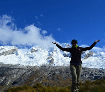
Santa Cruz Trekking
Day One (Praia)-3,890 Meters Above Sea Level
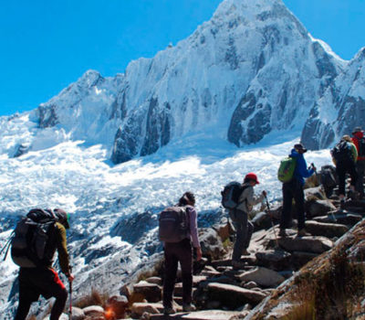
Usually we leave at 6 AM from Huaraz toward Vaqueria. On the way we pass Carhuaz and Yungay. Continuing the road we make various stops to have breakfast, in the Parque Nacional Huascaran in order to make the payment of 65 Nuevo soles. Then we continue on the path, observing two beautiful lakes whose names are Lake Llanganuco. At kilometer 42, we admire mountains such as Huascaran Norte, 6,664 meters, Chopicallqui, 6,354 meters, Pisco, 5,752 meters, Wandoy, 6,356 meters, etc. We continue ascending, passing by Portachuelo, 4,767 meters. Then we descend toward Vaqueria, where the mule drivers await us. This journey takes us about 5 and a half hours. We begin the trek with a descent for about 40 minutes followed by a mild ascent of about 3 hours. On the way we observe many plants and flowers with a multidimensional variety. Furthermore we see from afar the snowy peak whose name is Chaclaraju, 6,112 meters. Halfway up the trail we find an office of the National Park where they check the tickets. Continuing our trekking we arrive at the campsite called Paria.
Day Two (Taullipampa)-4,250 Meters Above Sea Level
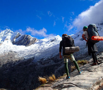
We begin the walk after breakfast at about 7 AM, climbing in a fairly difficult ascent. In this valley we observe many plants such as the quenual, quisuar, etc. pastures that beautify the landscape. It takes us about 6 hours to reach Punta Union Pass, which is at 4,750 meters. From this point we observe various mountains such as Arteson Raju, 6,025 meters, Paramond, 5,600 meters, Alpamayo, 5,947 meters, Taulliraju, 5,830 meters, etc. As is the custom, we take their respective photos. Continuing the trek, we descend to the campsite, which is about 2 hours downhill.
Day Three (Llama Corral)-3,870 Meters Above Sea Level
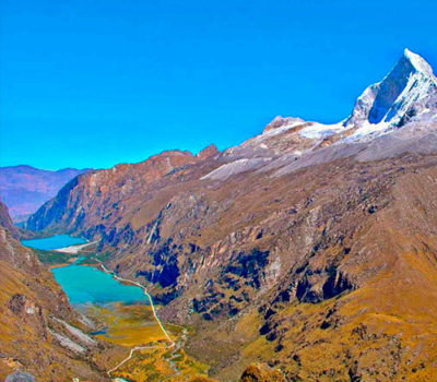
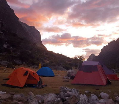
We begin the walk on a flat path for about 20 minutes. Next we encounter 2 paths. One heads toward Lake Arguhaycocha, which is at the base of the mountain called Pucajirca-6,050 meters, which takes us 3 extra hours and the other continues through the whole valley until it arrives at the campsite. It will take us some 4 hours, so this route to the vista point and Lake Arguehcocha is optional but impressive, with a spectacular view. From this point we admire the mountains Alpamayo, 5,947 meters, Paramond, 5,600 meters, etc. Other people who do not choose this path continue to the campsite, in a beautiful valley. Halfway through this route we encounter a mountain called Quita Raju, 6,036 meters, at the base of which is an impressive lake whose color changes according to the angle of the sun. On the path we encounter varieties of plants that decorate the landscape.
Day Four (Cashapampa)-2,900 Meters Above Sea level
We begin walking at about 8 AM. It is an easy day that will take us only about 3 hours, one flat hour and 2 hours of descent. These pass through a narrow valley full of bushes and flowers that beautify the landscape. Once arrived at Cashapampa, the bus awaits, which will take us to Huaraz. It is about 3 hours to complete the trekking, taking us to our hostels which represents the final step in our 4-day trekking.
Include:
- List 1
- List 2
Not Include:
- List 1
- List 2
NECESSARY EQUIPMENT FOR TREKKING
- Walking Sticks (optional)
- Rain Coat—————————- Winter
- Altitude Sikness Pills
- Water Purification Tablets
- Sun Glasses
- Sun Cream
- Back Pack
- Nylon Pants (waterproof)
- Gloves
- Sun Hat
- Market bag for the 2-3 kilos
- Warm Hat
- Toilet Paper
- Toothbrush– Colinos
- Warm Clothes
- clothes to bathe in the pool
- Snacks for the day
- Coca leaf for the height
- 150 Soles for National Park
THE COMPANY SUPPLIES:
- Sleeping Bags
- Mattresses
- Tents
- Donkey Driver
- Donkeys
- horse (optional)
- Guide, Cook
- Transportation There—Back.
- Chairs
- kitchen Tents- Dining Tents
- Food (Breakfast, Lunch and Dinner)
- Oxygen for Height
- First aid kit
- Overview
-
Overview
Santa Cruz Trekking
- Itinerary
-
Itinerary
Day One (Praia)-3,890 Meters Above Sea Level
Usually we leave at 6 AM from Huaraz toward Vaqueria. On the way we pass Carhuaz and Yungay. Continuing the road we make various stops to have breakfast, in the Parque Nacional Huascaran in order to make the payment of 65 Nuevo soles. Then we continue on the path, observing two beautiful lakes whose names are Lake Llanganuco. At kilometer 42, we admire mountains such as Huascaran Norte, 6,664 meters, Chopicallqui, 6,354 meters, Pisco, 5,752 meters, Wandoy, 6,356 meters, etc. We continue ascending, passing by Portachuelo, 4,767 meters. Then we descend toward Vaqueria, where the mule drivers await us. This journey takes us about 5 and a half hours. We begin the trek with a descent for about 40 minutes followed by a mild ascent of about 3 hours. On the way we observe many plants and flowers with a multidimensional variety. Furthermore we see from afar the snowy peak whose name is Chaclaraju, 6,112 meters. Halfway up the trail we find an office of the National Park where they check the tickets. Continuing our trekking we arrive at the campsite called Paria.
Day Two (Taullipampa)-4,250 Meters Above Sea Level
We begin the walk after breakfast at about 7 AM, climbing in a fairly difficult ascent. In this valley we observe many plants such as the quenual, quisuar, etc. pastures that beautify the landscape. It takes us about 6 hours to reach Punta Union Pass, which is at 4,750 meters. From this point we observe various mountains such as Arteson Raju, 6,025 meters, Paramond, 5,600 meters, Alpamayo, 5,947 meters, Taulliraju, 5,830 meters, etc. As is the custom, we take their respective photos. Continuing the trek, we descend to the campsite, which is about 2 hours downhill.
Day Three (Llama Corral)-3,870 Meters Above Sea Level
We begin the walk on a flat path for about 20 minutes. Next we encounter 2 paths. One heads toward Lake Arguhaycocha, which is at the base of the mountain called Pucajirca-6,050 meters, which takes us 3 extra hours and the other continues through the whole valley until it arrives at the campsite. It will take us some 4 hours, so this route to the vista point and Lake Arguehcocha is optional but impressive, with a spectacular view. From this point we admire the mountains Alpamayo, 5,947 meters, Paramond, 5,600 meters, etc. Other people who do not choose this path continue to the campsite, in a beautiful valley. Halfway through this route we encounter a mountain called Quita Raju, 6,036 meters, at the base of which is an impressive lake whose color changes according to the angle of the sun. On the path we encounter varieties of plants that decorate the landscape.
Day Four (Cashapampa)-2,900 Meters Above Sea level
We begin walking at about 8 AM. It is an easy day that will take us only about 3 hours, one flat hour and 2 hours of descent. These pass through a narrow valley full of bushes and flowers that beautify the landscape. Once arrived at Cashapampa, the bus awaits, which will take us to Huaraz. It is about 3 hours to complete the trekking, taking us to our hostels which represents the final step in our 4-day trekking.
- Services
-
Services
Include:
- List 1
- List 2
Not Include:
- List 1
- List 2
- Additional Info
-
Additional Info
NECESSARY EQUIPMENT FOR TREKKING
- Walking Sticks (optional)
- Rain Coat—————————- Winter
- Altitude Sikness Pills
- Water Purification Tablets
- Sun Glasses
- Sun Cream
- Back Pack
- Nylon Pants (waterproof)
- Gloves
- Sun Hat
- Market bag for the 2-3 kilos
- Warm Hat
- Toilet Paper
- Toothbrush– Colinos
- Warm Clothes
- clothes to bathe in the pool
- Snacks for the day
- Coca leaf for the height
- 150 Soles for National Park
THE COMPANY SUPPLIES:
- Sleeping Bags
- Mattresses
- Tents
- Donkey Driver
- Donkeys
- horse (optional)
- Guide, Cook
- Transportation There—Back.
- Chairs
- kitchen Tents- Dining Tents
- Food (Breakfast, Lunch and Dinner)
- Oxygen for Height
- First aid kit

