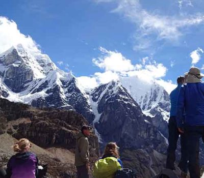
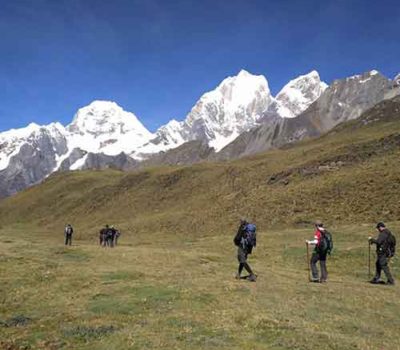
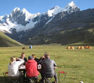
On the itinerary of this trekking are the most impressive parts of the Huayhuash Mountain Range, among whose majestic summits we find Peru’s second highest peak, Yerupaja, 6,634 meters above sea level, the famous Siula, 6,344 meters tall, Sarapo, 6,127 meters, Shirishanca, 6,094 meters, and many more beautifying the landscape. This route, which takes 8 days, is a great option for travelers who are short on time, offering daily panoramic vistas.
Day One (Matacancha)-4,180 Meters Above Sea Level
Usually we leave Huaraz at 9 AM. The journey is about 5-6 hours in total, to arrive at the first camp site. On this day there is no walking, only camping, although from this campsite you can observe some mountains like Rondoy, at 5,879 meters, Ninashanca, at 5,607 meters, etc. and it prepares us physically for the following days.
Day Two (Carhuacocha)-4,150 Meters Above Sea Level
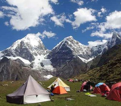
After breakfast, we begin a climb that takes about 3 hours toward the Cacanan Punta pass, which is at 4,700 meters. Next, we descend for about an hour and pass close by Lake Mitucocha, where we stop to take some photos. After that, we continue the climb, which takes about 3 hours, toward the Carhuac pass (4650 meters). From this point we can observe Yerupaja Grande at 6,634 meters, Siula, 6,344 meters. While descending we observe a lake called Carhuacocha and camp at its shores with a spectacular view.
Day Three Huayhuash-4,280 Meters Above Sea Level
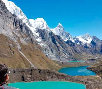
On this day we have two options, which means there is a path for the donkeys and the other is for the clients. The latter, which offers better views, takes us on a flat path for two and a half hours. En route we observe the three lakes of different colors, called Jangracocha, Sillacocha, and Siulacocha, as well as mountains such as Siula, at 6,344 meters, Yerupaja at 6,634 meters, Jirishanca at 5,445 meters etc. Then we begin to descend for approximately 3 hours toward the pass at 4,800 meters, and after that we descend for two more hours. On the way we can see more lakes. Continuing on our easy way, we arrive at the campsite.
Day Four (Viconga)-4,320 Meters Above Sea Level
We begin to walk at about eight in the morning, slightly uphill toward the pass, for about three hours (Portachuelo, 4,750 meters). From this point we can see a splendid valley with mountains at both sides. On the left is the Raura Range and on the right is the Huayhuash Range. Next we descend for about two hours. On the way we find Lake Viconga. After, we arrive at the camp, which is located next to thermal waters and with an impressive view.
Day Five (Huanaypatay)-4,350 Meters Above Sea Level
We leave at about 7 AM, climbing for about three hours to the Coyuc Pass-5000 meters, from which we can appreciate some mountains such as Sarapo, 6,127 meters, Trapecio, 5,844 meters, Puchcanturpa, 5,442 meters, Jurau, 5,850 meters, etc. After taking pictures we continue the descent for about an hour. Halfway down there is a detour to go to the San Antonio viewpoint, but it is optional and will take us about 3 more hours. Continuing on the main path, flat, with a valley full of pastures, we arrive at the campsite.
Day Six (Huatiac)-4,450 Meters Above Sea Level
After breakfast we begin a difficult climb during which we will see waterfalls of different sizes and dimensions and the plants and flowers that beautify the landscape. This path takes about 4 hours until the village of Huayllapa. Here we stop for 40 minutes to buy some supplies. After we continue the climb for about 3 hours up to the campsite. From there we observe Diablo Mudo (5,223 meters), which is an easy climb.
Day Seven (Jahuacocha)-4,130 Meters Above Sea Level
After breakfast we begin the upward trek. It is about 3 hours to Tapush Pass, 4,800 meters. From there we can appreciate the Cordillera Blanca Range. Continuing the descent, we encounter a lake called Nawincocha, which will take about 40 minutes to pass. After we begin climbing again for about 2 hours up to the Yaucha Pass, 4,800 meters. Continuing we head toward the vista point to admire Yerupaja Grande, 6,634 meters, Yerupaja Chico, 6,121 meters, Jirishanca Grande, 6,094 meters, Jirishanca Chico, 5,445 meters, Rasac, 6,017 meters, Tsacra, 5,548 meters, and more mountains. Below these we encounter various lakes such as Solteracocha, Lake Rasac, and the same Jaguacocha. After taking pictures we follow a steep descent toward the campsite at Jahuacocha, from which we encounter a beautiful lake at the side of the campsite.
Day Eight (Huaraz)-3,100 meters above sea level
Usually we leave Jaguacocha toward Llamac at 7 AM. It is an easy day because the path is completely flat. The journey takes about 3 hours. On the way we pass a multitude of plants and see from afar the mountains of the Cordillera Blanca Range. Halfway through the path we begin to descend which will take us about 2 hours to the Village of Llamac. From there the car is waiting, which will take us to Huaraz in about 5 hours. Once we arrive at Huaraz, we take our clients to their hostels which is the end of the service.
Include:
- List 1
- List 2
Not Include:
- List 1
- List 2
NECESSARY EQUIPMENT FOR TREKKING (Huayhuash)
- Walking Sticks (optional)
- Rain Coat—————————- Winter
- Altitude Sikness Pills
- Water Purification Tablets
- Sun Glasses
- Sun Cream
- Back Pack
- Nylon Pants (waterproof)
- Gloves
- Sun Hat
- Warm Hat
- Market bag for the 4-5 kilos
- Toilet Paper
- Toothbrush– Colinos
- Warm Clothes
- clothes to bathe in the pool
- Snacks for the day
- Coca leaf for the height
- 210 Soles for “Protection”
THE COMPANY SUPPLIES:
- Sleeping Bags
- Mattresses
- Tents
- Donkey Driver
- Donkeys
- horse (optional)
- Guide, Cook
- Transportation There—Back.
- Chairs
- kitchen Tents- Dining Tents
- Food (Breakfast, Lunch and Dinner)
- Oxygen for Height
- First aid kit
- Overview
-
Overview
On the itinerary of this trekking are the most impressive parts of the Huayhuash Mountain Range, among whose majestic summits we find Peru’s second highest peak, Yerupaja, 6,634 meters above sea level, the famous Siula, 6,344 meters tall, Sarapo, 6,127 meters, Shirishanca, 6,094 meters, and many more beautifying the landscape. This route, which takes 8 days, is a great option for travelers who are short on time, offering daily panoramic vistas.
- Itinerary
-
Itinerary
Day One (Matacancha)-4,180 Meters Above Sea Level
Usually we leave Huaraz at 9 AM. The journey is about 5-6 hours in total, to arrive at the first camp site. On this day there is no walking, only camping, although from this campsite you can observe some mountains like Rondoy, at 5,879 meters, Ninashanca, at 5,607 meters, etc. and it prepares us physically for the following days.
Day Two (Carhuacocha)-4,150 Meters Above Sea Level
After breakfast, we begin a climb that takes about 3 hours toward the Cacanan Punta pass, which is at 4,700 meters. Next, we descend for about an hour and pass close by Lake Mitucocha, where we stop to take some photos. After that, we continue the climb, which takes about 3 hours, toward the Carhuac pass (4650 meters). From this point we can observe Yerupaja Grande at 6,634 meters, Siula, 6,344 meters. While descending we observe a lake called Carhuacocha and camp at its shores with a spectacular view.
Day Three Huayhuash-4,280 Meters Above Sea Level
On this day we have two options, which means there is a path for the donkeys and the other is for the clients. The latter, which offers better views, takes us on a flat path for two and a half hours. En route we observe the three lakes of different colors, called Jangracocha, Sillacocha, and Siulacocha, as well as mountains such as Siula, at 6,344 meters, Yerupaja at 6,634 meters, Jirishanca at 5,445 meters etc. Then we begin to descend for approximately 3 hours toward the pass at 4,800 meters, and after that we descend for two more hours. On the way we can see more lakes. Continuing on our easy way, we arrive at the campsite.
Day Four (Viconga)-4,320 Meters Above Sea Level
We begin to walk at about eight in the morning, slightly uphill toward the pass, for about three hours (Portachuelo, 4,750 meters). From this point we can see a splendid valley with mountains at both sides. On the left is the Raura Range and on the right is the Huayhuash Range. Next we descend for about two hours. On the way we find Lake Viconga. After, we arrive at the camp, which is located next to thermal waters and with an impressive view.
Day Five (Huanaypatay)-4,350 Meters Above Sea Level
We leave at about 7 AM, climbing for about three hours to the Coyuc Pass-5000 meters, from which we can appreciate some mountains such as Sarapo, 6,127 meters, Trapecio, 5,844 meters, Puchcanturpa, 5,442 meters, Jurau, 5,850 meters, etc. After taking pictures we continue the descent for about an hour. Halfway down there is a detour to go to the San Antonio viewpoint, but it is optional and will take us about 3 more hours. Continuing on the main path, flat, with a valley full of pastures, we arrive at the campsite.
Day Six (Huatiac)-4,450 Meters Above Sea Level
After breakfast we begin a difficult climb during which we will see waterfalls of different sizes and dimensions and the plants and flowers that beautify the landscape. This path takes about 4 hours until the village of Huayllapa. Here we stop for 40 minutes to buy some supplies. After we continue the climb for about 3 hours up to the campsite. From there we observe Diablo Mudo (5,223 meters), which is an easy climb.
Day Seven (Jahuacocha)-4,130 Meters Above Sea Level
After breakfast we begin the upward trek. It is about 3 hours to Tapush Pass, 4,800 meters. From there we can appreciate the Cordillera Blanca Range. Continuing the descent, we encounter a lake called Nawincocha, which will take about 40 minutes to pass. After we begin climbing again for about 2 hours up to the Yaucha Pass, 4,800 meters. Continuing we head toward the vista point to admire Yerupaja Grande, 6,634 meters, Yerupaja Chico, 6,121 meters, Jirishanca Grande, 6,094 meters, Jirishanca Chico, 5,445 meters, Rasac, 6,017 meters, Tsacra, 5,548 meters, and more mountains. Below these we encounter various lakes such as Solteracocha, Lake Rasac, and the same Jaguacocha. After taking pictures we follow a steep descent toward the campsite at Jahuacocha, from which we encounter a beautiful lake at the side of the campsite.
Day Eight (Huaraz)-3,100 meters above sea level
Usually we leave Jaguacocha toward Llamac at 7 AM. It is an easy day because the path is completely flat. The journey takes about 3 hours. On the way we pass a multitude of plants and see from afar the mountains of the Cordillera Blanca Range. Halfway through the path we begin to descend which will take us about 2 hours to the Village of Llamac. From there the car is waiting, which will take us to Huaraz in about 5 hours. Once we arrive at Huaraz, we take our clients to their hostels which is the end of the service.
- Services
-
Services
Include:
- List 1
- List 2
Not Include:
- List 1
- List 2
- Additional Info
-
Additional Info
NECESSARY EQUIPMENT FOR TREKKING (Huayhuash)
- Walking Sticks (optional)
- Rain Coat—————————- Winter
- Altitude Sikness Pills
- Water Purification Tablets
- Sun Glasses
- Sun Cream
- Back Pack
- Nylon Pants (waterproof)
- Gloves
- Sun Hat
- Warm Hat
- Market bag for the 4-5 kilos
- Toilet Paper
- Toothbrush– Colinos
- Warm Clothes
- clothes to bathe in the pool
- Snacks for the day
- Coca leaf for the height
- 210 Soles for “Protection”
THE COMPANY SUPPLIES:
- Sleeping Bags
- Mattresses
- Tents
- Donkey Driver
- Donkeys
- horse (optional)
- Guide, Cook
- Transportation There—Back.
- Chairs
- kitchen Tents- Dining Tents
- Food (Breakfast, Lunch and Dinner)
- Oxygen for Height
- First aid kit

